Things seem more approachable when it appeals to your eyes. Visual representation of data is preferred all around the world, not just because it looks good, but it is also easier to interpret. Geographic information system is one such application that does so.
GIS software helps users analyse and interpret intellectual geographical data to solve problems related to current trends, existing patterns and building relationships.
What is GIS Software?
GIS software analyses and interprets geographical data to solve problems related to popular trends and patterns. It also builds relevant relationships based on different geographical factors. GIS software for MAC and windows, both are available. You don’t have to worry about how to use GIS software as it is very easy to use. The most popular GIS software are available here.
In short, GIS software can store and visualise geographic information in a map. It collects geographical data from maps to assess real-world problems.
From storing new locations to predicting climate changes, GIS software helps you connect data with geography and vice-versa. Viewing and interpreting raw data like latitude and longitude coordinates can be difficult if done with an excel sheet.
But with GIS software, you can visualise it in the form of informative pictorial representations. It also displays different kinds of data on one map, facilitating deep analysis.
Most-Searched Types of GIS Software
There are different types of Geographic Information System available for retrieving, storing and analysing spatial/geographic data. People often search for commercial GIS software or free GIS software for students.
You can use these types of GIS software for commercial and educational purposes to develop maps and such graphic representations to assess geographic data.
Desktop GIS
Desktop GIS software is used for creating, visualising and analysing GIS data. The software manages this through such technical tools as interactive street displays, spreadsheets, databases and digital atlases. The information is provided in the form of thematic maps and complex report forms.
Web GIS
Web GIS application is a kind of distributed information system comprised of a server (GIS server) and a client (desktop/mobile application and web browser). This platform uses web technology for communicating between a server and a client. Users can access the information through the URL that helps end users find information.
Server GIS
Server GIS is most primarily used for sharing geospatial data. The platform, designed for interoperability, is used for publishing data from any major spatial data source using open standards. The software has other features enabled such as WMS (Web Map Service), WFS (Web Feature Service), WCS (Web Coverage Service), WMTS (Web Map Tile Service), etc.
Specialized GIS
Specialised GIS software performs specific functions for specific industries. For instance,undertaking analytical functionality in order to identify risks and help organisations solve these. It is also used for doing performance monitoring tasks for fire and rescue services. The platform isused as a versatile planning constraints tool.
Image Classification
Image classification software is used for transforming pictures of the earth into more meaningful map data, such as land use classes, types, etc. This classification of software is based on spectral information mechanism so that images could be converted into more informative text for the ease of understanding.
Lidar
Light Detection and Ranging or LIDAR is based on remote sensing technology for measuring the features of the earth’s surface and creating Digital Elevation Model (DEM). For the purpose, it uses digital laser beams to hit the targeted point and record immediately the energy that gets reflected back. LIDAR instruments are typically comprised of laser, scanner and a specialised GPS receiver.
List of Top 10 GIS Software for Analysing Geographic Data
- Surfer
- Strater
- Geosoft Target
- ArcGIS Software
- GM-SYS Modelling
- Maptitude
- Intergraph
- Easy Trace
- eSpatial
- Bentley Maps
There are different types of GIS mapping software applications present in the market that can help you analyse your geographical data. Create, manage, analyse and display your data on the map with the help of these best GIS software available in the market:
Surfer

Surfer Software is a geographic information system that visualizes and creates enhanced maps and models with various options for customization. This geographic information system can re-define your maps and models with the finest details. Surfer is packed with an advanced LiDAR feature. LiDAR is one of the advanced data collection methods used in fields like GIS, archaeology, and surveying.
Features of Surfer GIS Software:
- Model data in multi-dimensions: View your data in three dimensional space with Surfer’s 3D viewer. You can model and analyse all aspects of your data by switching between its 2D and 3D perspectives. This can help you ensure that you cover all of your data’s pattern.
- LiDAR Point Clouds: LiDAR is a data collection method used for processing and visualizing data by creating point cloud from multiple LAS/LAZ files. You can assign colour schemes by colour intensity, elevation, and return number. Importing data like Nth point, return type, classification value and specified source ID.
- Streamlined workflows: Surfer’s user interface is designed to make things easier. With the content window, you can easily manage layers of maps and models. You will get a single window to view, and edit the data and maps. There is also a worksheet window to view or edit raw data.
- Enhanced Maps & Models: Visualize and model all types of data with Surfer’s extensive customization options which allow you to simplify complex data to an easy format. Enhance your maps with its various customizations options. You can add legends, cross sections, scale bars, multiple axes and magnifiers. Even add text, polygons, symbols, and polylines with this GIS map software.
- Meaningful Decisions: With Surfer’s geoprocessing tools, you can process your data and analyze data relationships. You can highlight major intersections, perform mathematical calculations, calculate attribute values, Perform Delaunay triangulation and create/modify polylines, polygons, and grids.
Surfer GIS Software Price: The price is available on their website.
Strater

With Strater online GIS software, you can achieve insights and clarity by transforming raw data into easy to understand well logs and borehole models. You will be able to create high quality geotechnical reports that communicate vital information. With Strater, you can view and analyze hidden areas and make well-informed decisions.
Features of Strater GIS Software:
- Professional Well Logs and Borehole Models: With Strater, you can discover new insights about your data. By achieving a better understanding of your data, you will be able to make informed decisions.
- Clear Subsurface Data: You have the ability to easily create cross sections from line or symbols, zone bar logs, or raster logs to understand the details of your data in a better way. And as known, maximized understanding makes your decisions better.
- Enhanced Geological Model: You have the ability to represent your data in the best possible way. With the variety of customization options in its logs, models, and cross sections, you can include titles, scale bars and axes. Draw text, polylines, polygons, symbols, and spline polylines and create standardized templates to create consistent reports.
- Top-Down View: You can create top-down maps to view the information of well log and borehole inside the software. Use schemes to quickly apply symbol, fill, and other line properties. Also, save them for future to be used in multiple projects. Options to add boundary information and image base maps are also available.
- Easy Collaboration: Share your well logs and borehole models with team members and clients. The maps and models that you build are ready for printing in high quality formats like PDF or TIFF. Also, you will be able to insert diagrams into presentation tools like Microsoft Word or PowerPoint with just copy and paste.
Strater GIS Software Price: Please request demo for this GIS software.
Geosoft Target

With Geosoft Target, you can create insightful data and great geological models to enhance your decision-making ability. This software will help you get intuitive geological modelling and analysis through multi-disciplinary geoscience.
Features of Geosoft Target Software:
- Easy import and organization: The import wizard and the huge Geosoft database will help you import and organise all your project data. You will be able to work with more than 50 supported data formats including GIS, CAD, mine planning and modelling.
- Conduct Ongoing QA and QC: You can perform QA and QC by processing large volume of data, validating them, indentifying the discrepancies and correcting them. Also, calculate average values in composite database and significant intersections.
- Surface Mapping Integration: To improve subsurface integration, you can create maps using various methodologies like geology, geochemistry, geophysics, and GIS data. You can create grids, add different contours, and remote sensing data. With built-in ESRI integration, it is possible to work across different GIS environments.
- Geological modelling: You can view your data in both 2D and 3D. Also, building 3D geological models with its easy-to-use wire framing interface. With your drill hole data, you can create 3D voxel block models and isosurfaces as well. There is also an option to calculate volume and grade estimates based on geological models.
- Quality Analysis: An advanced geochemical analysis is included in this GIS system software which helps in effectively importing and analyzing your data. By using summary statistics, histograms, principle component analysis and probability analysis, you can conduct geochemical analysis effectively.
Geosoft Target Price: Please request demo for this GIS software.
ArcGIS Software

The ArcGIS software is a part of Esri Geospatial Cloud, which enables you to connect data and locations using interactive maps. With intuitive analysis tool, location intelligence is achieved accurately.
Features of ArcGIS Software:
- Make maps and share them: Create maps instantaneously by the data in your spreadsheet using ArcGIS online. Make them visually attractive by applying smart mapping styles. You can also share your maps with your fellow team members.
- Data analysis: The intuitive analysis tool helps you get insights about your data. Combine Esri’s demographic to add concrete value to your data.
- Developer tools: Special developer tools are available through APIs and SDKs so the developers can use these in maps and analysis. They can also develop custom apps using these developer tools.
- Field operation: With this GIS software, you can connect field operations with office operations by creating maps and apps for those in the field. You can take offline, and sync automatically when connected to the internet.
- Advanced workflows: You can create and edit 2D and 3D maps that has custom base maps and precise labelling. You are given the option of automating data manipulation workflows in your system as well.
ArcGIS Software Price: Please request demo for this GIS software.
GM-SYS Modelling

GM-SYS Modelling software is ideal for gravity and magnetic modelling. It also supports creation of advanced interpretations with seismic, well, and structural data. GM-SYS modelling can effectively model complex subsurface structures.
Features of GM-SYS Modelling:
- Data Integration: View data with different range of density and susceptibility. Visualize model gravity and magnetic data using response curves, surface data, and LAS well files.
- Profile modelling: GM-SYS profile modelling is a feature in 2D modelling workflow. You can create a geologic model of the subsurface and compare their gravity and magnetic responses as well.
- 3D modelling: With GM-SYS 3D, explorers can build layered 3D models that accurately depict the variation and irregularity of subsurface structures and calculate the models’ gravity and magnetic responses.
- Supports Graphics Formats: It supports various graphics formats. You can export vectorpostscript drivers to Adobe Illustrator, CorelDraw, DGM, DXF and Geosoft plot files.
- Forward Gravity Calculation for Draped Surveys: This GIS software application implements a new gravity calculation method to provide accurate results. This method can be used on draped surveys without upward continuation.
GM-SYS Modelling Price: Please request demo for this GIS software.
Maptitude

MaptitudeGIS uses geoscientific analysis for creating elegant visualizations of maps, performing business analysis and data integration of corporate revenue. These are necessary for developing commercial solutions based onwell researched demographics.
Features of Maptitude:
- Intuitive wizards: The software provides a feature for setting up wizard to develop thematic maps. Go to file, press the New key and select Map. You can easily develop colored maps, #D prism maps and dot-density ones through Maptitude.
- Territory tools: Use territory tools for territory mapping toeffectively manage sales, distribution and coverage. The software tracks and balances multiple territory features as a result of which it is possible to justify and defend lucrative territories without the possibility of over representing them.
- TransModeler and TransCAD: Both these options help end users receive directions for delivery of products to reduce costs of logistics. You can handle multiple deliveries and carry out route planning for managing stops, rest points and driving tracks. Maptitude uses algorithms through routing manager for identifying shortest routes.
- Powerful visualizations: It maps data through flow maps, heat maps, surface analysis, territory mapping and drive-time rings. The topological and geographical editing tools of Maptitudedo network analysis and raster image reprojection/registration.
- Demographic data: Geospatial analysis is possible as there is plenty of data available. There is also available free offline address level geocoding.
Maptitude GIS Software Price: The price of Maptitude GIS starts at Rs. 51,225, and different plans ar available on their website.
Intergraph

Intergraph software offers geospatial solutions in the form of business intelligence, aerial digital camera, video analysis solutions and geomedia. This GIS software provides physical information security management through computer aided dispatch.
Features of Intergraph:
- Interfacing: Use securityconnect for EdgeFrontier to quickly create interfaces for applications, devices and systems. The feature also helps in reducing the cost of ownership.
- Intelligent maps: Leverage the integrated GIS for refined 2D and 3D view. Such maps are highly informative as they depend on intelligent defaults and data driven styling for developing thematic maps.
- Detection: You can integrate data sources and different devices for reducing risk of cyber threats such as spyware and malware. You can also track, detect and control devices to identify potential security risks.
- Scalability and Interoperability: Integraph helps integrate diverse devices by coordinating multiple resources and locations. You can also visualize assets in a common operating picture.
Integraph GIS Software: The price is available on their website on request.
Easy Trace

Easy Trace is a vectoriser or an AutoCAD-oriented digitization program. It is a cartographic raster to vector conversion tool for multithreading and editing topologically connected objects. Take advantage of automatic object recognition and such utilities for topological structure control and automatic correction.
Features of Easy Trace:
- Compound Tools: Compound tools in Easy Trace auto detect circles and combine images. It is also possible to move objects from layer to layer and create cover images through this software. You can easily duplicate and combine images.
- Line form optimization:Merge pseudo-nodes and maximize appropriation precision through line form optimization. Optimize the preview mode through this easily configurable feature.
- Buffer zone generation: The diameter of a zone is always fixed and there is an option available to select the object type you would want to add around the zone. You can easilyattach common attributes after selecting more than one source.
- Vector tracer: Vector tracer helps search for lines, arcs and convert them into vector lines, polygons, curves and such vector entities. Through this, you can easily remove bugs. The tracer is also useful in removing the possibility of odd lines appearing in place of deleted spikes.
- Corrector: Extend and merge polyline through a corrector without any error. Also specify the distance between polylines through this option. Then it is also possible to merge by the angle of three points (two nodes and one click point).
Easy Trace GIS Software Price: The price of Easy Trace GIS software starts at Rs 80,007.
eSpatial
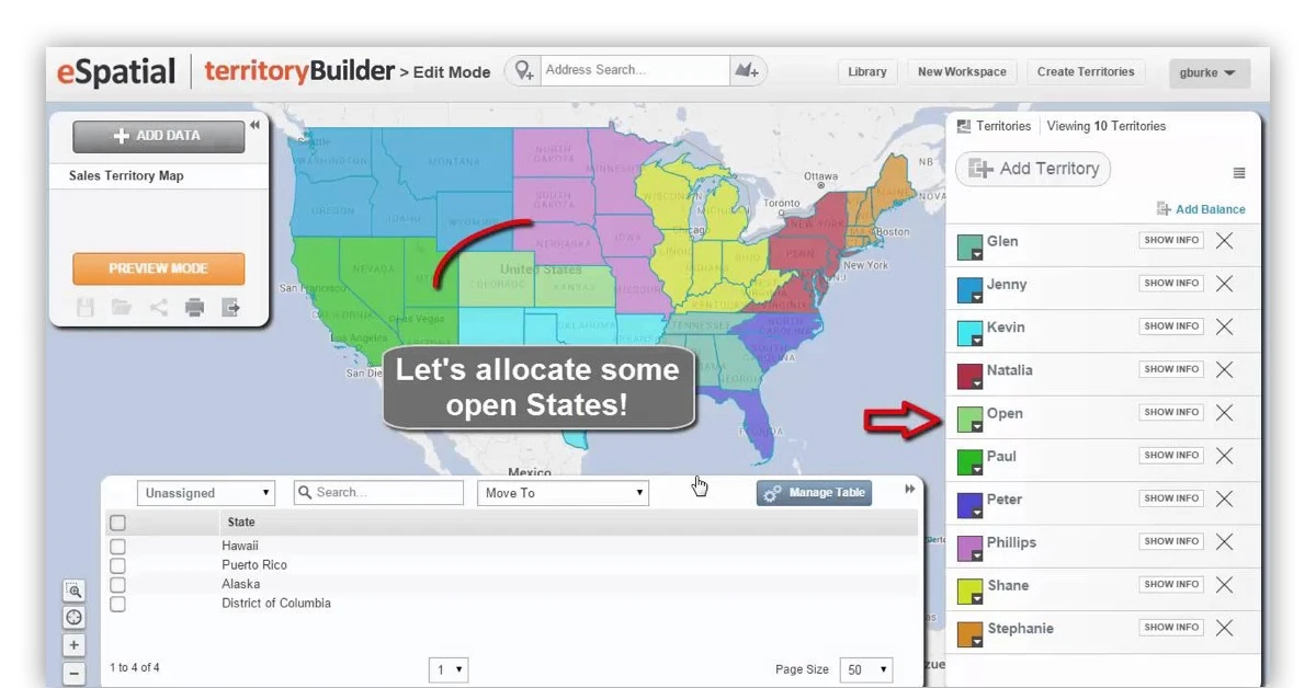
eSpatial is a cloud-based mapping software for visualizing, analysing and uploading several layers of data.The mapping software uses advanced geographic analysis for the purpose. eSpatial solution plansthe routefor sales teams, filter potential customers and rollout territories for your staff.
Features of eSpatial:
- Hot spot heat maps: Identify multiple customers and highlight new opportunities present outside the current territory. Recognize trends in sale of specific products in particular locations. You can also locate such locations based on the density of sales.
- Map annotations: Map annotations help users understand maps with more ease as they can add context, instructions, texts, corporate logos, videos, slideshows and images. You can use the customization option to change fonts and even embed videos.
- Territory management: Manage franchises and field sales for efficiently handling the business of profitable areas. The tool is further useful in providing on-site services to customers and developing good customer relations to maximize sales.You can manage your sales territory and existing/ potential customers.
- Map interaction summary: Use map interaction summary to drop pin on a map and filter data. It ensures the ease with which data sheets can be shown or hidden as well as basemaps can be changed.You can also search for locations and change colors by turning on/off colour by value.
eSpatial GIS Software Price: Its Pro plan starts at Rs 95,431 per year.
Bentley Maps
Bentley is used to unify disparate 2D/3D data and remove such data as well. This software offers flexible API for creating GIS applications. Let’s make use of Bentley’s Map Mobile app available in different versions such as powerview and enterprise to create quality maps.
Features of Bentley:
- 2D/3D spatial analysis: Take up spatial analysis by using buffering, 3D clash detection and overlay features inbuilt within this software solution. It allows users to undertake both shadow and solar analysis through this platform.
- Geospatial data: Manage and update spatial data stored in Oracle Spatial and Microsoft SQL Server. You can also import and view WFS (Web Feature Service) data immediately. It also incorporates data in Esri formats by importing and exporting SHP files.
- Maintain 3D city models: Handle structured and unstructured 3D city model data such as geospatial, architectural, engineering designs, point clouds, and reality meshes with Bentley GIS. It allows easy integration with enterprise spatial databases, such as Oracle Spatial and SQL Server Spatial.
- Develop cartographic maps: Develop cartographic and thematic maps by creating several pages in map books that have borders, populated fields, dynamic labeling, text placement, grid, graticule generation, drop shadows and halo effects.
Bentley GIS Software Price: The price is available on request.
Best 5 Open Source & Free GIS Software
Go through a list of top five open source GIS mapping software for understanding their specific functionalities. Aside from offering such functions as data management, image processing, automating map production and rector/vector analysis, the open source GIS software also provides specific functions for analyzing geographic information system.
QGIS
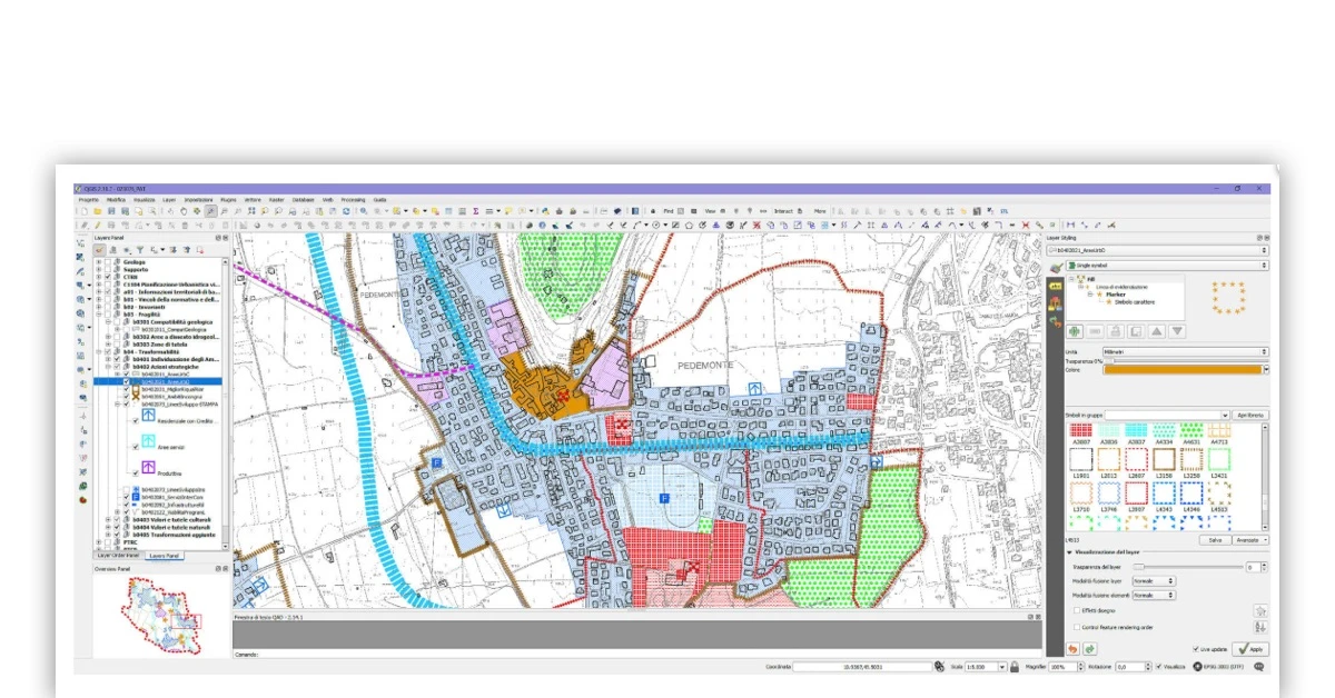
QGIS or Quantum GIS is an open source GIS software used for analysing and editing geospatial data. This open source platform composes/exports graphical maps and depends on raster/vector layers. You can use QGIS for supporting shapefiles, coverage, personal geo databases and MapInfo.
Features of QGIS:
- DB Manager
- Map Composer
- Spatial bookmarks
- Annotation tools
- QGIS browser
- On the fly reprojection
- OpenStreet Map data
uDIG
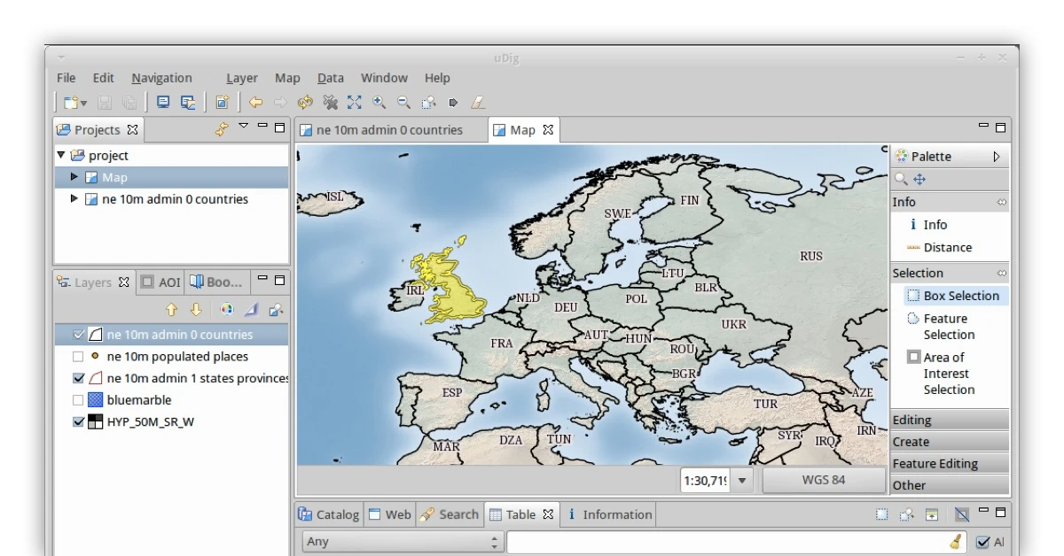
uDIGis an open source GIS software that depends on Eclipse platform. Used most widely for developing GIS applications, uDIGcan be extended into RCP plug-ins. Thus you can also use it as a plug-in within an existing application.
Features of uDIG:
- Drag and drop integration
- Integration with existing infrastructure
- Geospatial web services
- De facto geospatial web services
- Advanced spatial raster formats
- Style layer descriptor
- Deep integration of standards
- JTS Topology Suite
OpenJump
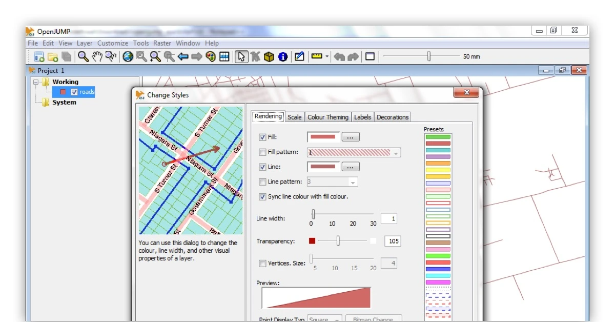
OpenJump is an open source GIS mapping software used for editing and attributing data in the software’s map display. It is also possible to export data into SVG. You can utilise vector analysis tools for topologic analysis and overlay operations. Further, it helps add coordinate reference system, spatial database analysis and bug fixing through OpenJump platform.
Features of OpenJump:
- Multiple geometries
- Add/remove vertices
- Auto-complete polygon
- Warping
- Simplify polygons/lines
- Rapid prototyping of GIS functions
SAGA GIS

SAGA or System for Automated Geoscientific Analyses is meant primarily for geodata analysis and processing. This open source GIS software has a robust API, programmed within the system designed and object oriented C++ language. It is specifically used for georeferencing and cartographic projections.
Features of SAGA:
- Intuitive data management and visualization
- Grid interpolation of scattered point data
- Image analysis
- Portable
- Scripting through command line
- Modular structure
- Geodata handling.
GRASS GIS

GRASS or Geographic Resources Analysis Support open source GIS software is used for geospatial data analysis and management. Graphics, image processing and maps production are other core features of the platform. It is powered by a 3D-raster.
Features of GRASS GIS:
- Temporal framework
- Erosion modeling
- Watershed analysis
- Point data analysis
- Solution transport
- Map creation
Conclusion
These are the top GIS software available in the market. You can select any of these different types for there various GIS software uses. You can check out other software applications available for GIS. If you know about any other software, let us know in the comments section below

Written by
Riya Basu
![]()
Riya Basu, a core member of the content team at Techjockey.com, has previously worked with several brands related to lifestyle, travel, education and f&b. However, technical content writing is currently her niche with more than 2 years of experience in writing about business software and hardware. She is... Read more